The Peaks of the Balkans Trail is a long-distance trekking route originally designed as a 192 km transnational hike crossing Albania, Kosovo, and Montenegro. Today, the distance of the trail offered is 168 km, due to the redesigned section between Valbona and Çerem, which now avoids the tractor road and includes Qafa e Persllopit — one of the most dramatic and rewarding stages.
In this page you can find many information about, border permits, maps, distances, weather, wildlife, cultural notes, best season and other. Thank you for reading.
The route follows historic Ottoman mule-trade paths, abandoned after the formation of the Kingdom of Yugoslavia and Albania’s independence in 1912. In this year, Yugoslavia invaded what was the Ottoman Empire and included the majority Albanian-speaking lands in their country. The modern trail was developed by local mountaineers with support from GIZ, in 2010, becoming one of the most successful sustainable tourism projects in the region.
For you booking:
Go to our Booking Page;
Learn more about our guided tours see what is the best for you ;
Learn more about our self guided tours from 5 to 10 days.
This remote area was historically poor and underdeveloped, yet always attractive to explorers. Writers such as Edith Durham and Rose Wilder Lane documented these mountains long before tourism existed. The two western writers, one English and one American, were fascinated by the life in these mountains and the Albanian traditions. The most famous Albanian writer Ismail Kadare write a book situated in these mountains, which depicts ancient traditions of renvenge killings and a couple who decided to make this mountain a destination of their honeymoon. The book Broaken April was turned into a french movie Avril Brise and brasilian film called Behind the Sun.
The mountains were divided through centuries as the Albanian and Montenegrin neghbours did not have the best relations. Now in peace times as the BBC writes:
“The trail bridges three previously war-torn nations and crosses through some of the continent’s least-explored landscapes.”
Or, the Financial Times adds:
“This remote and mysterious mountain range, much of it accessible only by foot, offers more than beauty.”
Peaks of the Balkans trail is the best Balkans hiking adventure. Our experts design tours based on your travel date and other preferences. BNA can design an itinerary from 5 to 15 days of hiking. You can start and finish the hike in any of the countries: Albania, Kosovo, or Montenegro. Check our reviews on TripAdvisor.
The Financial Times has traveled with us. Watch the VIDEO or read the article of the Financial Times, when they visited Peaks of Balkans with Balkan Natural Adventure.
READ MORE BELLOW THE PICTURE
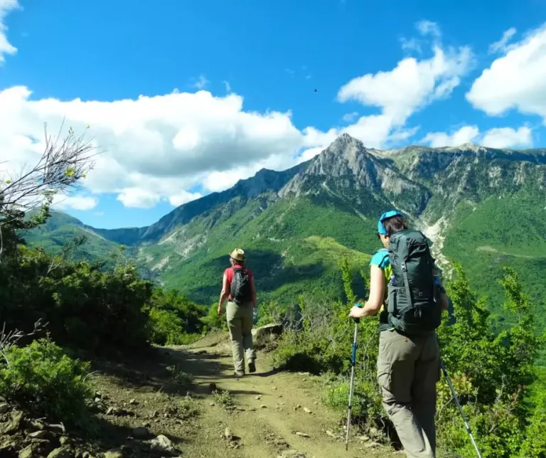
The Peaks of the Balkans Trail is one of Europe’s most diverse long-distance hikes: high mountain passes, glacial valleys, remote villages, and multiple cultures — all in a single itinerary.
The trail is ideal because it is:
As Francine Dellone from Paris said after hiking with Donika, a guide from Kosovo:
“The Peaks of the Balkans is breathtaking. The photos speak for themselves. And changing countries on foot is such a unique experience.”
Within one day, hikers may:
For Europeans, the trail is reachable via three airports within 2 to 4 hours flight. Prices remain reasonable, and local people genuinely welcome visitors.
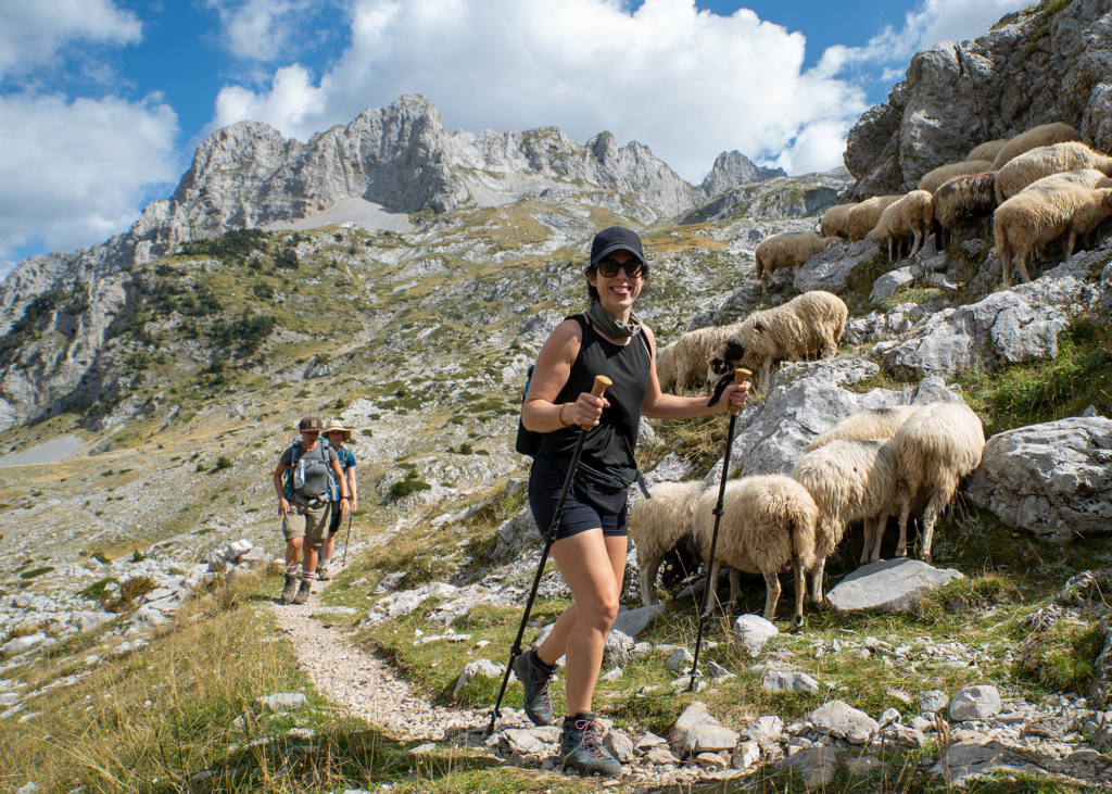
The media have covered the trail and a BBC article highlights how the Peaks of the Balkans offers an “utter remoteness” rarely found in Europe today. It describes hikers moving through “green valleys and wildflower-strewn meadows” under the jagged profile of the Accursed Mountains. The trail is highly valued by hikers due to diversity, exceptional panorama and the people of the region. In a world where overtourism is becoming a pain for locals and visitors Peaks of the Balkans is the opposite. Welcoming locals who rely in tourism, beautiful scenery still somehow hidden as most people avoid longer hikes.
The Peaks of the Balkans Trail offers:
Martin Fletcher in the Financial Times wrote:
“Beneath the bluest sky… we admired jagged peaks, deep green bowls and pristine valleys stretching in every direction.”
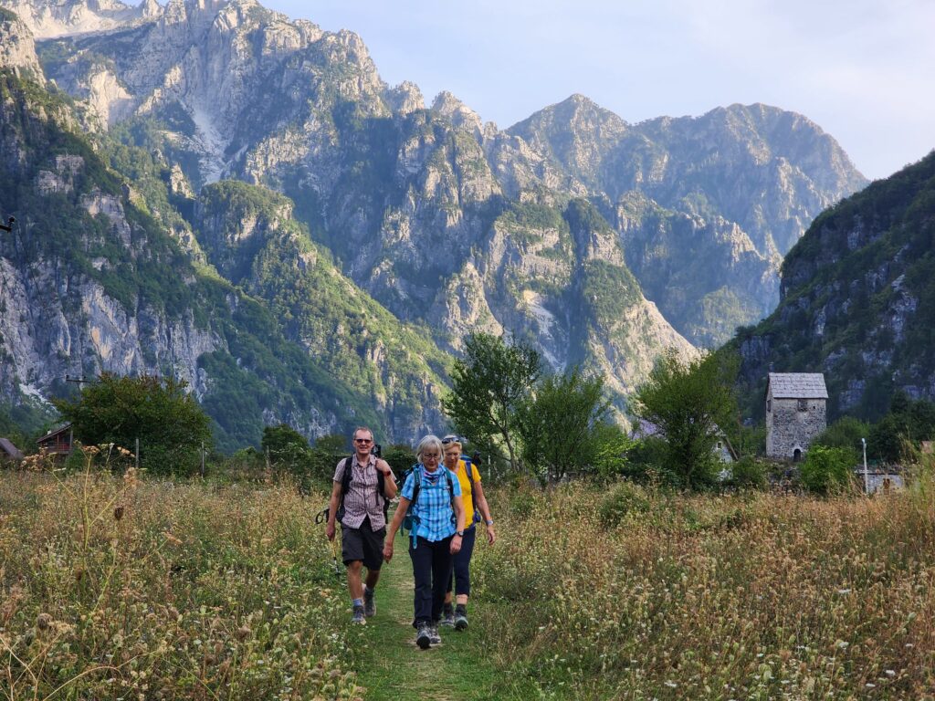
Though no longer a hidden gem, the Peaks of the Balkans remain one of Europe’s last truly wild and least-explored regions. Villages once divided by conflict, religion, and closed borders — Muslim, Catholic, and Orthodox — are now linked by slow travel along the trail. Modern comforts like Wi-Fi reach almost every guesthouse, yet ancient pastoral traditions still dominate the landscape. Shepherds graze goats and cows in isolated hamlets just as their ancestors did for centuries. This mix of cultures and eras gives the trail exceptional depth: hikers witness living tradition, Cold War history, and modern cross-border cooperation all in a single journey.
This trail is generally rated as moderate in industry terminology, with daily elevation gains or losses typically staying below 1,000 metres. Depending on the rating system used, the classification may vary slightly, but it consistently falls within the category of hikes suitable for the general public, without requiring technical mountaineering skills or the experience of hardcore adventurers.
For a detailed breakdown of the different systems used to assess the route, see our dedicated section: Rating of the Peaks of the Balkans.
The Peaks of the Balkans is a moderate–to–difficult mountain trail, but two risks deserve special attention: snow in early/late season, especially on the Valbona–Theth Pass where past fatalities occurred due to inexperienced hikers walking on snow without proper equipment; and stomach illness, which peaked in 2023 and improved in 2024–2025. Hikers should follow strict hygiene rules, drink clean water, and never walk on steep snow without consulting professionals, guides, or using the winter trail. As guide Mentor Vokshi reminds: “Always stop to take photos — never film while walking.” Paying attention to footing and following safety advice keeps the trail safe and enjoyable. Read the full safety article.
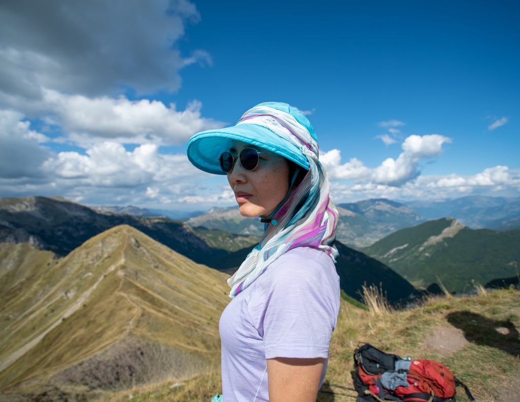
This is the most iconic section of the Peaks of the Balkans Trail, offering spectacular views over Valbona and Shala valleys. The cultural contrast is unique: Theth is Roman Catholic, while Valbona is predominantly Muslim.
If hiking from Theth, the climb is steeper but the descent is easier.
Safety Note:
This pass becomes dangerous during early snowfalls (June or late September). A lower winter route avoids the exposed section. Read our latest post Aprill 2026 about winter pass.
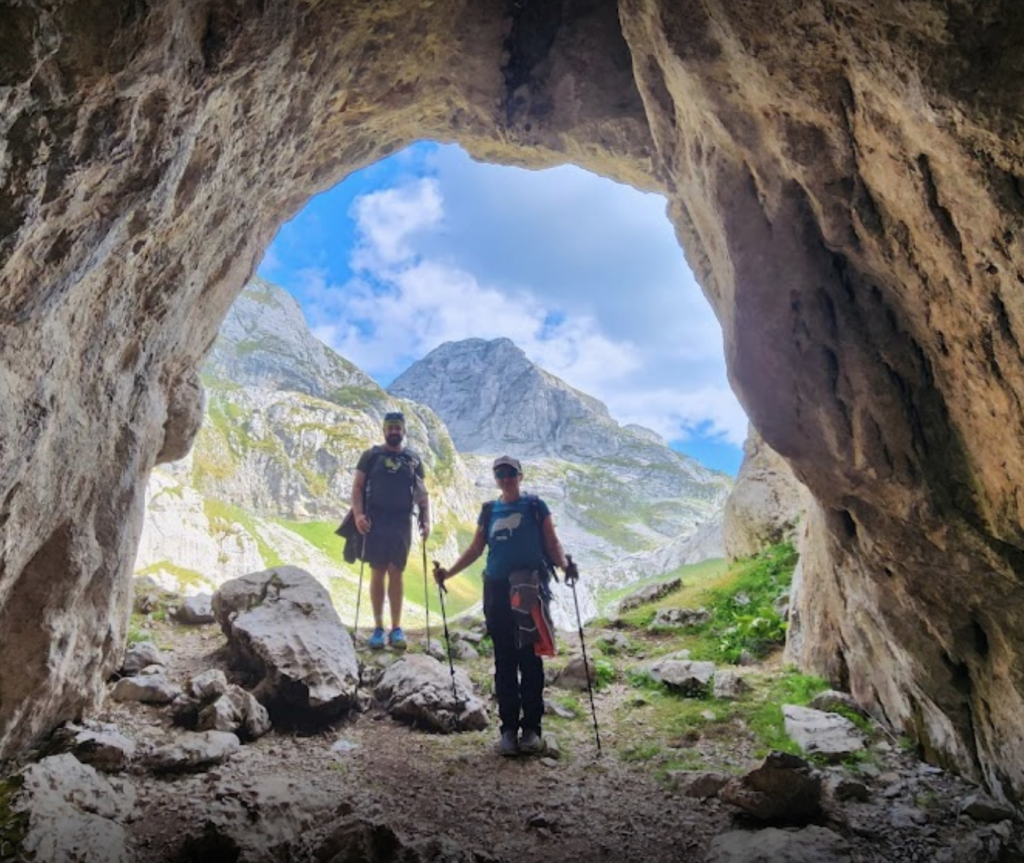
This challenging pass replaced the old tractor road to Çerem. It can be combined with Maja e Kollatës, making a demanding but rewarding day hike. This peak is also the highest peak in Montenegro.
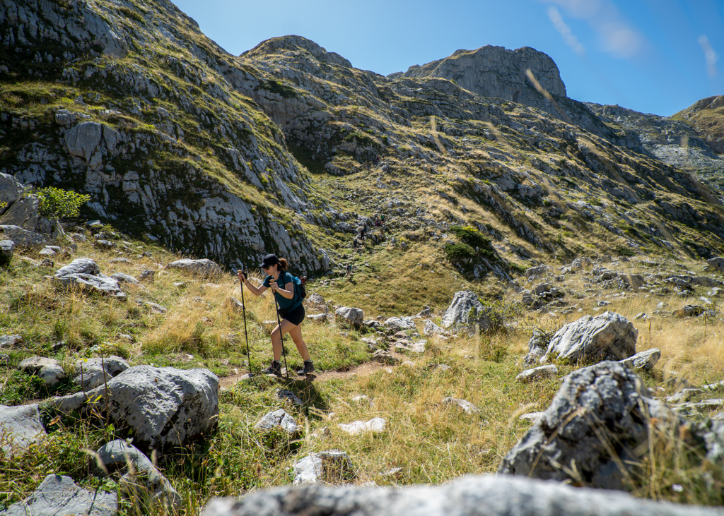
The section between Valbonë, Çerem and the Persllopi Pass includes one of the most demanding climbs on the Peaks of the Balkans trail. Shortly after leaving the village, the route begins a steep ascent, where hikers are advised to take their time and make frequent short breaks. The effort is well rewarded: with every step, the views over the Valbonë Valley become wider and more dramatic.
Once the steep section is behind you, the trail opens into alpine meadows and traditional shepherd valleys, where locals often sell fresh blueberries or homemade yogurt. From here onward, the terrain becomes more varied and full of exceptional viewpoints.
For experienced and strong hikers, this stage also offers the optional ascent of Maja e Kollatës, the highest peak in Montenegro, adding an unforgettable highlight to an already spectacular route.
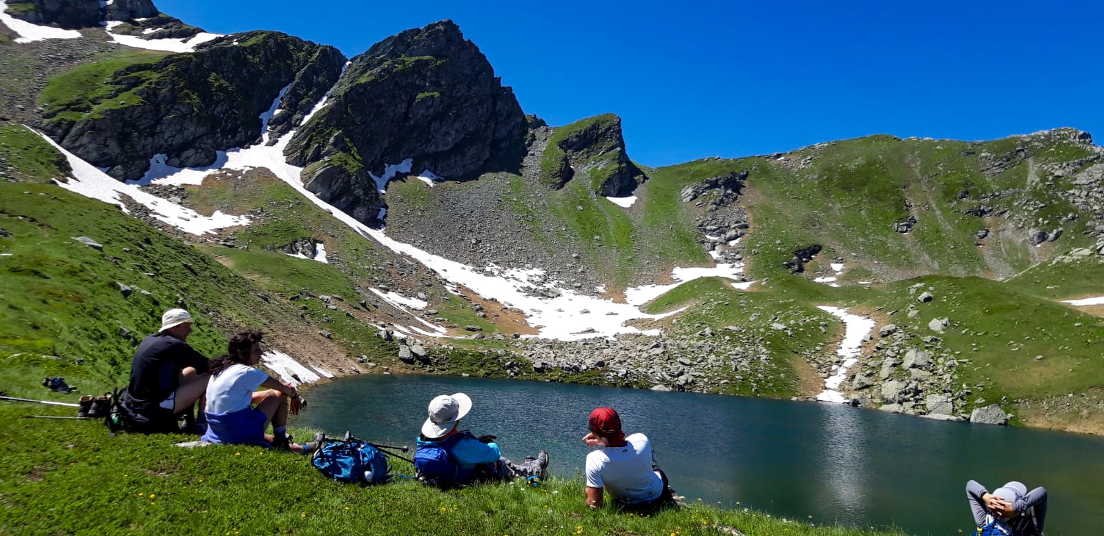
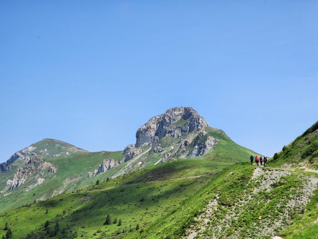
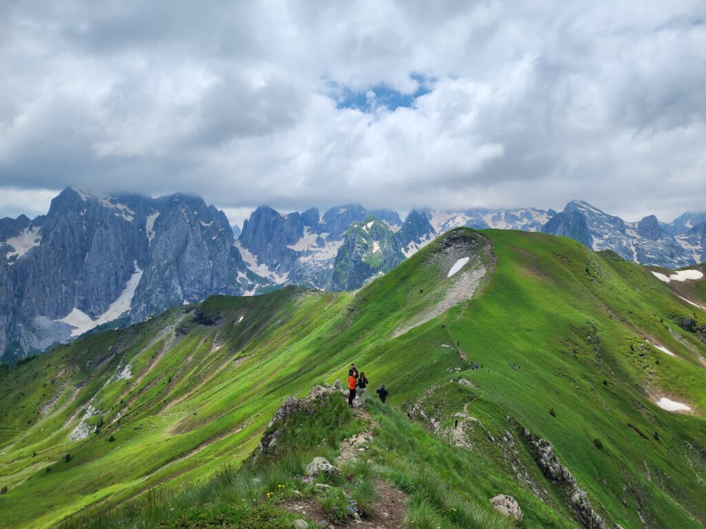
Three-Border Peak (Trekufiri) is the exact point where Albania, Kosovo, and Montenegro meet. It is one of the most iconic spots on the Peaks of the Balkans Trail, allowing hikers to step between three countries in under a minute. The closest village is Dobërdol, which serves as the natural base for climbing the peak.
The ascent from Dobërdol can be done as a loop hike or incorporated into the trail when heading toward Kosovo or Montenegro. The peak is visible from the high pastures, but hikers should remain on the marked trail—off-trail terrain includes steep slopes and dense knee-high shrubs that can block progress.
From the summit, hikers can descend in several directions:
A descent to Babino Polje creates a small circuit but skips the Kosovo section of the Peaks of the Balkans. By choosing this shortcut, hikers miss some of the trail’s most dramatic areas, including the routes toward Miliševa, Gjeravica, and the Gacaferri range.
The climb toward Gjeravica (2,656 m) branches off from Trekufiri and is not part of the original Peaks of the Balkans route. There are two ways to include it:
Both variations are rewarding extensions for hikers seeking Kosovo’s highest summit.
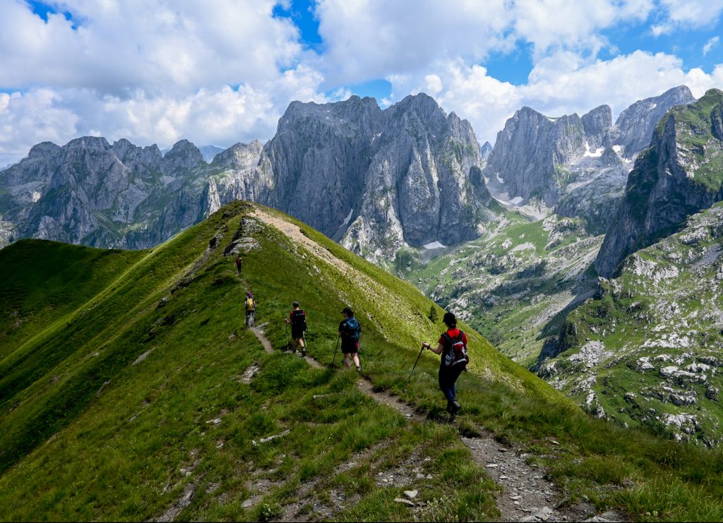
Descending from Three-Border Peak toward Milisevc follows the official Peaks of the Balkans trail. This section is especially scenic, tracking along a ridge where hikers literally walk the borderline between Kosovo and Montenegro. It is one of the classic and most memorable ridge walks of the entire route.
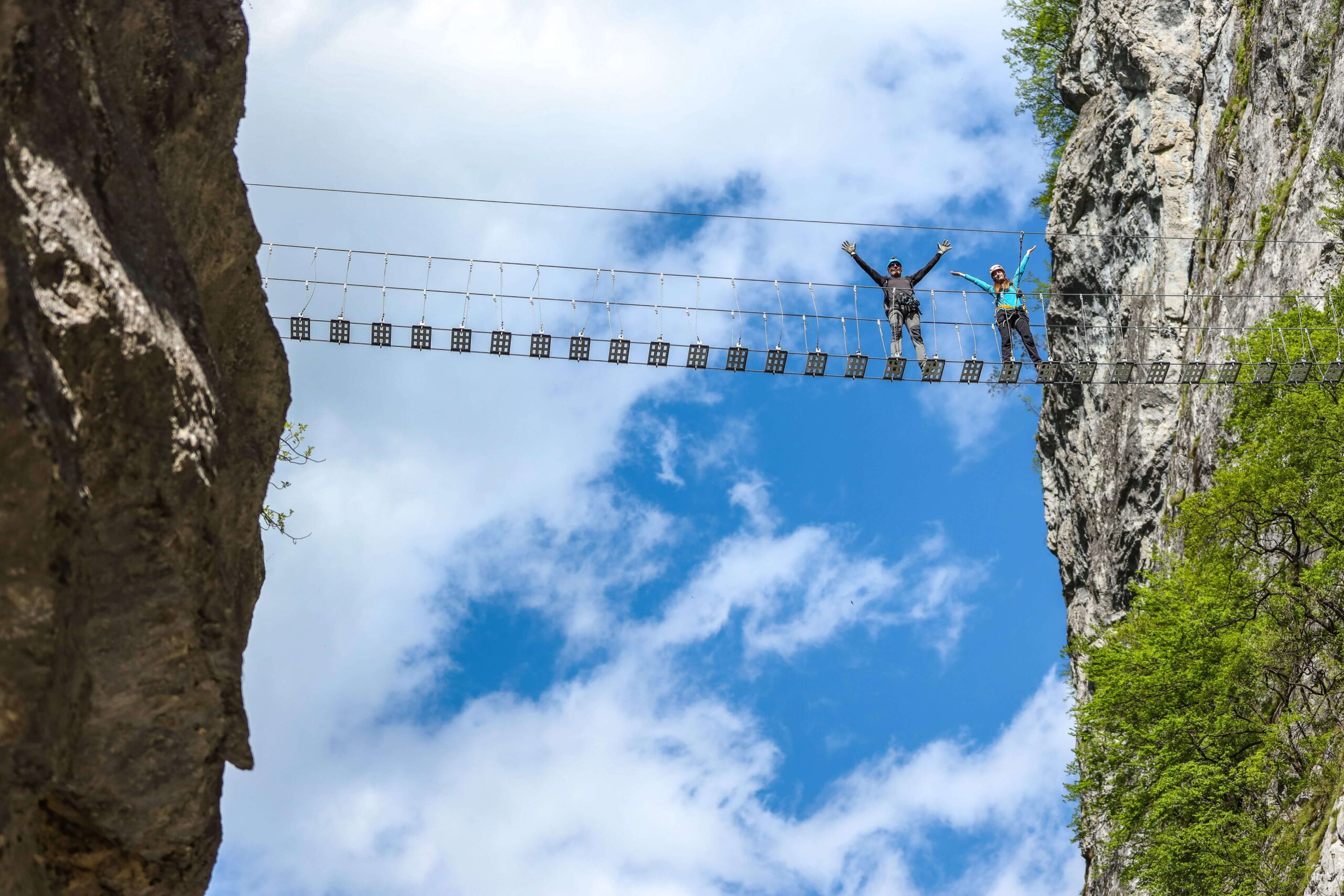
A dramatic viewpoint with razor-sharp peaks piercing the sky — often considered the “poster shot” of the trail. A romantic description for Maja e Karanfilit and Grebaje Valley, could be the karst towers Tolkien-esque as the peaks as “a forbidden fortress” towering above deep valleys. And this comes out after hikers pass over moss-covered rocks and through spruce and pine forests before the landscape suddenly opens into a dramatic limestone skyline. This mix of deep forest, high alpine basins, and razor-sharp peaks makes it one of the most photogenic and unforgettable sections of the entire trail. READ full article excursions in Peaks of the Balkans
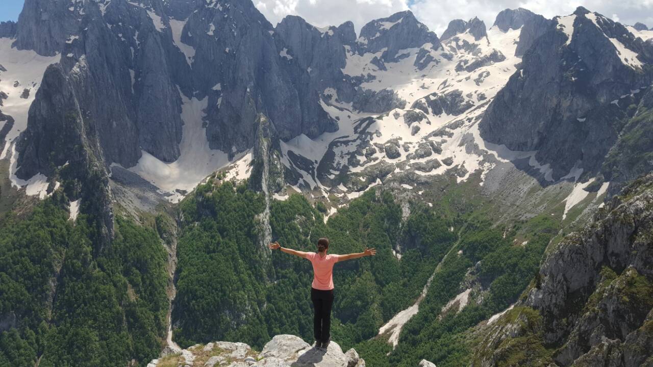
Kosovo’s highest mountain. Reachable as a loop from Dobërdol or as a continuation to the Gacaferi Guesthouse. The peak other than a highest peak of in your portfolio, offers 3600 views on the accursed mountains and access to two glacial lakes, where you can referesh in cold water in the middle of your hike.
The region was once a militarised Cold War frontier. Albania, one of the world’s most isolated states under Enver Hoxha, built thousands of concrete bunkers now scattered across the landscape.
BBC notes:
“Hoxha filled the country with up to 500,000 concrete bunkers for people to hide in case of attack.”
The trail also passes sites connected to the Kosovo War, traditional shepherd settlements, and villages shaped by centuries-old customs.
Albania was once “the North Korea of Europe,” sealed off from the outside world and filled with up to “500,000 concrete bunkers.” These bunkers appear throughout the Peaks of the Balkans, especially near former border zones. The Financial Times adds further depth, describing how Albania’s borders with Yugoslavia were “forbidden territory” for decades, where escape attempts were punished and border guards monitored the mountains 24/7. Together, these details show hikers that the beautiful scenery sits atop a complicated history of isolation, conflict, and resilience — a contrast that enriches the hiking experience.
Section by section analyses of the Peaks of the Balkans
What is considered as season is mid June to mid September. This period promises a better weather, less rain, longer days and a guarantee that all the guest houses and trails will be opened. However mid season mid July to mid august the temperatures go higher and there are more people in the trail. These seasons are busy due to school holidays. In this peak season temperatures go above thirty during the middle of the day and with this increases the risk of sun stroke and also food poisining.
Possible in April, May, and October with conditions:
Winter requires ski touring equipment and guide support.
Many villages along the trail, such as Theth and Valbona, remained isolated for most of the 20th century due to harsh winters and poor access roads. Theth, famously described by Edith Durham as offering “majestic isolation from all the world,” is especially vulnerable to early snowfall. This history helps explain why hikers in May or October must be prepared for sudden weather changes and why guesthouse operations differ depending on the season. Read more: Peaks of the Balkans in April and Peraks of the Balkans in November
Typical temperatures along the Peaks of the Balkans vary significantly by season; use the overview below to plan your gear and daily start times.
Shkodër – Main Starting Point for the Peaks of the Balkans
Shkodër is the largest city in northern Albania and one of the cultural capitals of the country. It is known for Rozafa Castle, the vast Shkodër Lake shared with Montenegro, and a lively pedestrian centre filled with cafés, restaurants, and museums. The city has long-standing ties with Italy due to centuries under Venetian influence, still visible today in architecture, cuisine, and local crafts—Shkodër is home to the largest producer of Venetian masks outside Italy.
For the Peaks of the Balkans Trail, Shkodër is the most common and convenient starting point. Travellers typically reach the mountains by:
Shkodër offers the best logistics, accommodation choices, and transport connections before entering the Albanian Alps.
Peja is attached to the Accursed Mountains and very close to the start of the trail. The city offers many natural attractions like numerous via ferratas, a large cave, museums, the Rugova gorge and a Zip Line.
Only 1h40m from Prishtina Airport.
Plav – Montenegrin Gateway to the Peaks of the Balkans
Plav is a small town in northeastern Montenegro and one of the three main starting points for the Peaks of the Balkans Trail. It is a long, 4-hour drive from Podgorica Airport, and the route can feel tiring due to winding mountain roads. Compared with Peja or Shkodër, Plav is much smaller and quieter, but it offers a peaceful base surrounded by dramatic alpine scenery.
The town sits beside Lake Plav, the largest glacial lake in the Western Balkans. Nearby is the natural monument the Source of the Grlja River (Izvor Grlje), a karst spring emerging from a limestone wall—a popular stop for hikers exploring the area.
The Peaks of the Balkans Trail literally runs through the centre of Plav, making it an easy and practical starting or ending point with guesthouses, markets, and transport connections for onward travel.
The Balkans lack trains. Transport relies on buses, vans, taxis, and private transfers.
Booking transfers via guesthouses or agencies is recommended.
Yes! Because Kosovo, Montenegro, and Albania are not EU or Schengen members, the region still operates under a full passport-control regime. On the Peaks of the Balkans Trail, hikers cross international borders on foot, and doing so legally requires a border-crossing permit.
Obtaining these permits independently can be time-consuming and confusing:
For most travellers, the easiest solution is to secure all permits through a licensed tour operator, who can manage the paperwork and ensure compliance with border regulations.
Yes. Border-crossing permits are required to legally cross between:
Montenegro requires in-person submission; Albania and Kosovo accept email requests.
Tour operators can handle permits. Click here for Balkan Natural Adventure Permit
Checks are irregular but do occur. Fines apply if you cross without permits.
Accommodation on the Peaks of the Balkans Trail
The Peaks of the Balkans Trail has grown significantly since its creation, with more guesthouses, family lodges, and even small hotels appearing along the route. The two most developed and popular areas are Valbona and Theth, which offer the highest number of accommodations. However, during the peak summer season, both valleys often fill up completely because they attract many tourists who visit independently of the long-distance hike.
Along the rest of the trail, accommodation is more limited and usually family-run, offering simple but warm hospitality. The areas with the lowest capacity are:
Most guesthouses can be booked directly through online platforms or Google Maps. However, because some accommodations have basic management systems, booking errors or double bookings can occasionally occur. Even if this happens, hikers are never left without shelter, but you may not always receive the exact room you reserved.
Booking early—especially for Valbona, Theth, Dobërdol, and Çerem—is strongly recommended during high season.
The Peaks of the Balkans Trail now has more accommodation, but capacity is limited in:
Peak season sees full occupancy in Theth and Valbona.
More on accommodation
For smooth trip and securing all of your bookings you can choose one of the products of Balkan Natural Adventure
Join our groups in this spectacular hike in the accursed mountains. Best guide to guest ratio, smaller groups, fast and reliable office support, in depth local knowledge.
Book Now – € 980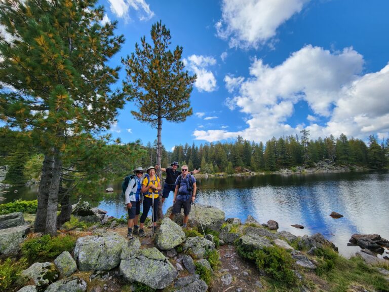
Come along on a delightful 6-day journey through the Peaks of the Balkans.
Book Now – € 595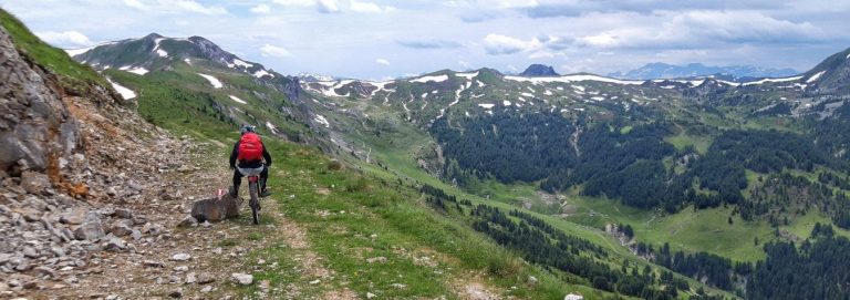
Peaks of the Balkans biking tour If you are in search of a mountain biking trip, join us, and soak in the idyllic beauty of breathtaking.
Book Now – € 650Hikers on the Peaks of the Balkans Trail should carry at least one litre of water at all times, and it is strongly recommended to bring water-purification tablets or a filter. There are many natural springs and refill points along the route, which are usually marked in the hiking notes provided by tour operators. Most guesthouses also offer water from local mountain sources, which is generally safe to drink.
Food along the trail has changed in recent years. With the growing number of visitors, some guesthouses now offer slightly more commercial or standardized meals, especially in the busier valleys. However, many smaller, family-run lodges still provide traditional homemade dishes, giving hikers a genuine taste of local cuisine.
Meals are typically based on bread, dairy products, meat, and garden vegetables, reflecting the region’s pastoral mountain culture. Vegetarian and vegan options are increasingly available, although choices may be simpler in remote areas.
Carry at least 1 liter of water.
Most guesthouses serve:
Vegetarian and vegan meals are possible.
Not allowed in national parks, but guesthouse yards allow camping for a fee.
Encounters with wildlife on the Peaks of the Balkans Trail are rare but possible. Over the past 20 years, only one recorded bear attack has occurred. In that case, a woman approached a bear cub and tried to play with it; the mother bear defended her young. She was injured and still carries scars, but her life was never in danger. As long as hikers keep distance and follow normal mountain behavior, risks remain extremely low.
The region is rich in flora and fauna, home to many species typical of Eastern Europe and the Balkans. Large mammals include brown bears, wolves, foxes, and the endangered Balkan lynx. In the sky, hikers may see golden eagles, vultures, and other birds of prey.
Smaller mammals are common, although there are no marmots, unlike in the European Alps. Mountain lakes and streams host trout and tritons (newts) that thrive in glacial waters.
Snakes are present, including vipers, black vipers, and nose-horned vipers. Bites are extremely rare, and according to our research, most incidents involved people attempting to pick up or handle the snakes. Staying on the trail and watching where you step is usually sufficient to avoid any danger.
Spotting wildlife is generally difficult. The animals are shy, and most avoid human contact. The most common sightings are foxes, usually early in the morning or late at night.
Traveling with Balkan Natural Adventure provides a complete package including transfers, food, and accommodation.
Typical prices:
These packages cover all logistics, border-crossing permits, local support, and overnight stays in guesthouses along the trail.
If you choose to organise the trek yourself, the average costs are:
Independent travel can be less expenssive overall, but requires personal handling of transfers, bookings, and border-crossing permits. Risks of cancellations and guest houses mixing your booking or givong it to the traveller who came before you if you are late.
The trail is considered very safe. There have been no reports of safety incidents, theft, or attacks on hikers. It is regularly used by solo travellers, including women, without any recorded cases involving people or wildlife. This region of the three countries is rated as safe by many Ministries of Foreign Affairs — including Israel’s. After the start of the Gaza war, all three countries were assessed as safer than France by several MFA travel advisories.
In terms of health safety, the last three years have seen cases of food poisoning and norovirus-related illness. Most incidents occurred in 2023, with fewer cases reported in 2024 and 2025. Travellers should take basic precautions: wash hands frequently, avoid contact with domestic animals such as dogs and cats, purify drinking water, and prioritise cooked food.
The trails are marked, but some guesthouse owners have added signs directing hikers toward their accommodation, which can lead people off the main route. Balkan Natural Adventure provides official GPX files and a professional offline navigation app that guides you not only to each village but also directly to the guesthouse you have booked. If you rely on general GPX files downloaded from the internet, always verify where the route ends—guesthouses can be several kilometres apart, and you may be guided away from your intended accommodation.
Guided tours offer a more relaxed and stress-free experience, allowing you to focus on walking rather than navigation, route-finding, or locating your guesthouse. Your guide handles all logistics, ensuring that you never worry about wandering off the trail or missing a turn.
Guides on the Peaks of the Balkans are more than mountain professionals. Beyond ensuring your safety, pace management, and correct trail navigation, they contribute significantly to the experience through:
On Balkan Natural Adventure tours, you also have the added benefit of traveling with a small group, meeting other hikers, and sharing the experience together.
From a practical perspective, guides are there to solve problems quickly—issues with bookings, food quality, communication, or any unexpected situations. In case of accident, illness, or injury, the guide provides immediate assistance and coordinates help where needed. Contact us in the contact form for your tour.
Self-guided tours offer more independence and a stronger sense of adventure. With Balkan Natural Adventure, you receive a dedicated navigation app that guides you from guesthouse to guesthouse, shows trail notes, and allows you to walk completely at your own rhythm. You can take breaks whenever you want, go faster or slower, and enjoy the freedom of hiking alone or with your partner or friends.
However, self-guided hiking comes with fewer comforts. If you experience an accident, illness, wrong booking, or logistical issue, you must handle the situation yourself or rely on the support of the agency you booked with. While support is there, the immediate presence of a guide is missing. Contact us in the contact form for your tour.
When preparing for your hike, make sure you carry all essential items for comfort and safety. Bring your passport and pack proper hiking equipment, including hiking boots, a 30–45L backpack, and 1–1.5 litres of water. Wear practical outdoor clothing such as synthetic hiking T-shirts, hiking pants, a fleece, and bring a rain jacket or poncho. Pack spare socks, gloves, a hat, sunglasses, suncream, and walking sticks. A camera, phone, or GPS can also be useful.
Temperatures can drop to 5°C even in June, so it’s best to dress in thin, layered clothing rather than thick jackets. Guesthouses on the route provide towels, shampoo, warm water, and other basic amenities.
In addition to the essential items listed above, it is useful to bring a few extra pieces of gear that can make your hike more comfortable and safer. Trekking poles are highly recommended for managing steep ascents and descents, while a power bank ensures your phone, GPS, or camera stays charged throughout the day. An eSIM or local SIM card helps maintain data coverage across all three countries. Water purification tablets or a small filter provide extra protection when refilling from natural sources. Snacks, energy bars, electrolytes, and a small multitool are practical to have on hand. Dry bags or zip-bags help keep valuables safe from rain, and carrying some cash is essential since many villages do not have ATMs.
Please click on seperate sections of the trail to have a short description. The green trails are those added by Balkan Natural Adventure for a better experience of the trail. More in the page Peaks of the Balkans map
Searching Availability…
Listen to the 30 minute podcast with one of the top Peaks of the Balkans guides.
This segment offers views of two valleys, Shala and Kelmendi, and includes the most southern glacier in the Northern Hemisphere, located in Albania. The path connects Theth (Thethi Guide), a predominantly Catholic Albanian village, with the Valbona valley. Both offer stunning views and a great hike. This section has become busier in recent years, as many tourists opt for this hike alone.
In early spring, when the snow is not yet melted, a lower trail should be taken to avoid accidents. In 2023, there were two fatalities due to snow and people slipping into abysses. Without snow, this path is technically easy.
Trail distance:
16.4 kilometers (Thethi church to Guesthouse Kol Gjoni)
Elevation min: 730 meters; max 1854 meters
Cumulative height uphill: 1175 meters; downhill: 940meters
Difficulty level: ● moderate
Time: 7 hours
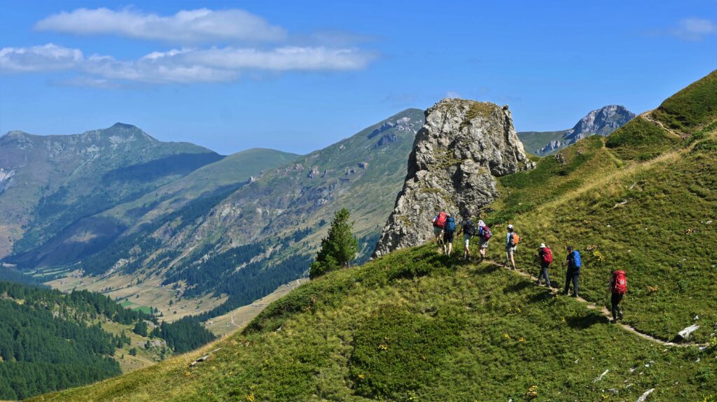
The original Valbona-Cerem trail is now seldom used. It partially followed a tractor road, rarely used by vehicles. With the trail’s growing popularity, this has become a busy route with operators transporting tourists’ luggage. Consequently, guides and operators have created a new trail next to Kollata e Madhe or Zla Kolata, Montenegro’s highest peak. This trail is challenging, with a very steep section, but the beauty and views are rewarding. More experienced hikers also tackle the Kollata peak.
Trail distance:
15.5 kilometers
Elevation min: 1215 meters, max 2039 meters
Cumulative height uphill: 1215 meters downhill: 1005 meters
Difficulty level: ● moderate
Time: 8-9 hours
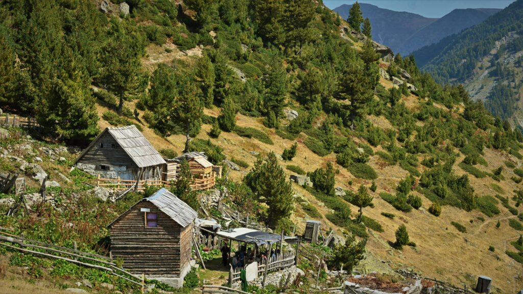
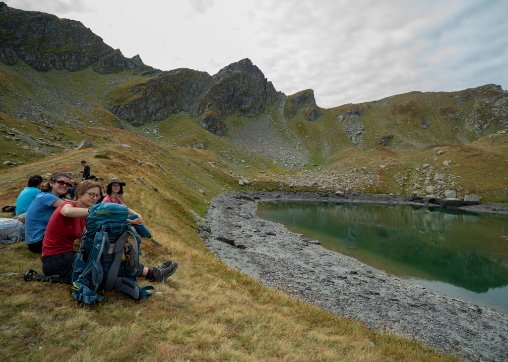
This segment is one of the most secluded on the trail, primarily hiked by those completing the entire route. It’s very beautiful and passes through a small village, offering a chance for a hearty lunch from local shepherds. This trail has remained unchanged since its establishment and takes you past primeval forests. In spring and summer, the blooming vegetation and endless valley views are breathtaking. The Gashi valley, a strictly protected zone where hikers are not allowed, can also be seen from here. You will get to Doberdol (See the video of Guest House Leonardi i Doberdol) which is the highest place you will sleep during the hike.
Trail distance:
16.8 kilometers
Elevation min: 1180 meters, max 1920 meters
Cumulative height uphill: 1100 meters downhill: 520 meters
Difficulty level: ● moderate
Time: 6 hours
This trail, linking Albania to Kosovo, hasn’t undergone significant changes over the years. A highlight is the three-border peak, where the three countries meet. The trail offers long walks along mountain crests with open views. This is when you will go from Albania to Kosovo in Milishevc or in Zlanopoje as some know it (See the video of guest house). On the Kosovo side, there’s a failed road project that has damaged the wildreness.
Trail distance:
17.6 kilometers
Elevation min: 1535 meters, max 2250 meters
Cumulative height uphill: 970 meters downhill: 1075 meters
Difficulty level: ● moderate
Time: 8-9 hours
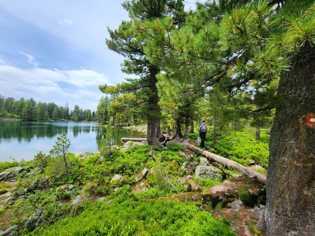
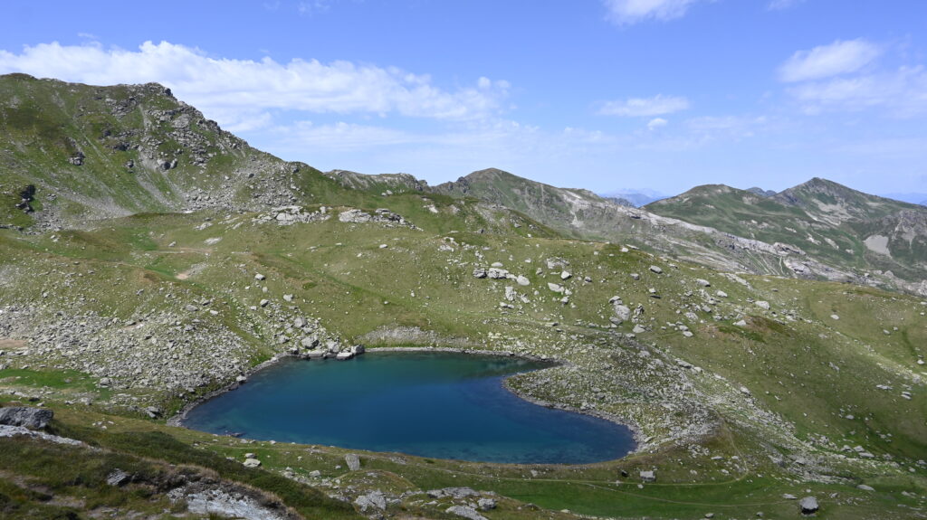
The Doberdol trail is also a starting point for other routes. One recommended option is to climb Mount Gjeravica, Kosovo’s highest peak, and return to Doberdol in a loop. This hike passes glacial lakes and offers wonderful views of the Accursed Mountains. However, it can be challenging in bad weather. Another option from Gjeravica is to head to Bjeshka Gacaferit, where a new guesthouse has opened.
Trail distance:
19 kilometers (round-trip)
Elevation min: 1765 meters, max 2656 meters
Cumulative height uphill: 1134 meters downhill: 1130 meters
Difficulty level: ● moderate
Time: 8-9 hours
Another variation from Doberdol is to head directly to Bjeshka e Gacaferit without going to Gjeravica. This shortens the hike and provides a welcome break from the previous challenging segments.After a night in this location you will continue joining the clasical Peaks of the Balkans trail and joining the Doberdol-Milishevc trail in Bjeshka e Dobroshit.
This original segment offers beautiful views of the Rugova Canyon as it passes near Guri Kuq peak. However, since part of the trail is now asphalted, many hikers avoid linking fully Milishevc with Reka e Allages. In some versions designed by Balkan Natural Adventure, you avoid three days and add other hikes, by going from Milishevc to Babino Polje.
Trail distance:
17.4 kilometers
Elevation min: 900 meters, max 2143 meters
Cumulative height uphill: 1128 meters downhill: 1503 meters
Difficulty level: ● moderate
Time: 8-9 hours
Optional: (Car Transfer to Reka Allages)
This hike passes through the other side of the river Lumbardhi, and it passes through many a village in the region. It trails through Rugova mountains, home to some of the most populated highland villages in the Kosovo’s part of the Accursed Mountains. The hike goes from Nikqi tribe to Shala in Drelaj and Kuqishte. As foreseen originally this trail now goes through a lot of asphalted roads, and some walks which would not be hikes. To avoid this is either to change the trail altogether or to take some transfers. One of the options is to finish the hike in Drelaj and take a transfer the next day to Kuqishte. Otherwise you can take a transfer the day of the hike. One detour to do this hike is add Hajla climb in it and get amazing views from the highest peak in this part of the mountain.
Trail distance:
21.8 kilometers
Elevation min: 1075 meters, max 1810 meters
Cumulative height uphill: 1340 meters downhill: 1235 meters
Difficulty level: ● moderate
Time: 8-9 hours
Optional: (Car Transfer Drelaj to Leqinat Guri Kuq 20 minutes: 10 kilometers)
This trail, as originally planned, is now rarely completed without transport due to new roads. From Kuqishte to Liqenat, the path is asphalted and best traveled by car, as noted before. The hike from Liqenat to Babino Polje in Montenegro is beautiful and it includes two glacial lakes at 1800 meters of altitude. With the trail of Balkan Natural Adventure the glecial lakes are included in the hike from Milishevc to Babino Polje. This trail takes you to Montenegro.
Trail distance:
15.1 kilometers
Elevation min: 1420 meters, max 2275 meters
Cumulative height uphill: 1147 meters downhill: 1049 meters
Difficulty level: ● moderate
Time: 7-8 hours
This two-part trail includes a beautiful segment to Hrid lake. However, the path from Hrid lake to Plav, passing through Treskovica, is partly on a tractor road, which can be unpleasant due to dust from passing vehicles. This part can be avoided by inclusion of a 7 k transfer from Gradina to Plav.
Trail distance:
15 kilometers
Elevation min: 1215 meters, max 2060 meters
Cumulative height uphill: 600 meters downhill: 955 meters
Difficulty level: ● moderate
Time: 5-6 hours
Optional: (Car transfer from settlement Gradina to Plav 15 minutes: 7 kilometers)
The option that Balkan Natural Adventure suggests is to take a transfer from Babino polje to do a hike outside the classical trail to the Grbaje valley. This hike will take you what was supposed to be the most beautiful valley in all Yugoslavia, when the countru existed from Slovenia to Macedonia. This was left out from the original trail as it includes a transfer, however we believe that the view and the hike totally is worth the detour.
BABINO POLJE, Montenegro – GREBAJE VALLEY LOOP, Montenegro – VUTHAJ/VUSANJE Montenegro
Trail distance:
9.5 kilometers (loop trail)
Elevation min: 1140 meters, max 2057 meters
Cumulative height uphill: 1100 meters downhill: 995 meters
Difficulty level: ● moderate
Time: 5-6 hour
Note: 1st Car transfer from Babino Polje to Grebaje Valley 1hr distance 31km – Beginning of the journey.
This segment passes through Plav town, then moves to rural areas and higher hills. It lacks particular highlights, and many people skip it. Instead, consider other hikes mentioned previously, such as in Gjeravica, or other visits. However if you decide to do this hike ot will take you to Bor peak to get a view on the town. The trail can be shortened with a transfer from Plav to the place called Karaulla.
Trail distance:
14 kilometers
Elevation min: 990 meters, max 2100 meters
Cumulative height uphill: 620 meters downhill: 1160 meters
Difficulty level: ● moderate
Time: 10-11 hours
Optional: (Car Transfer from Plav to Karaula point 20 minutes: 8 kilometers)
This epic hike from Vusanje or Vuthaj to Theth traverses rugged paths dotted with bunkers, starting and ending in green meadows. It is one of the hikes that has not changed and it does not need transfers to avoid asphalt. As the trail between Valbona and Theth is more crowded, this might be the best segment of the entire hike. It’s also the longest but can be shortened with transfers.
Trail distance:
17.1 kilometers
Elevation min: 730 meters, max 1745 meters
Cumulative height uphill: 795 meters downhill: 1250 meters
Difficulty level: ● moderate
Time: 8 hours


Balkan Natural Aventure is leading tour oprator in the region. We were featured to major newspapers and hold a partner status with travelife certifier.
Links
Destinations
Locations
Balkan Natural Adventure Sh.P.K
Edit Durham, nr 7
30000 Peje, Republic of Kosovo
Balkan Natural Adventure Albania
Rr. Milto Tutulani nr 26/8
1010 Tirana, Albania