Join us on this breathtaking beauty of the Accursed Mountains with this carefully designed guided tour. Ideal for travelers seeking a shorter loop of the renowned Peaks of the Balkans trail, this itinerary offers a scenic shortcut from Albania to Montenegro, bypassing Kosovo.
HIGHLIGHTS
Price: Euro 765; Three pax. to guarantee
Dates 2026: June 3 – 9; June 24 – 30; July 15 – 21; July 29 – August 4; September 2 – 8;
INTRODUCTION
Peaks of the Balkans is the first long-distance hiking trail through the Western Balkans, connecting remote regions via ancient paths. The trail passes villages divided by borders and fortified by bunkers from the communist era. It winds through diverse landscape, meadows, peaks, lakes, and forests, offering ever-changing views, from rocky paths to wildflower-rich meadows where nature thrives undisturbed, unlike in much of Western Europe.
PACKAGE INCLUDES
PACKAGE EXCLUDES
Arrive in Shkoder and check-in at the hotel. Meet the guide and group for a briefing from 19:00 to 20:00.
Nearby airports include Podgorica and Tirana (1.5 hrs), Tivat (2.5 hrs), Prishtina (3.5 hrs), and Skopje (4.5 hrs).
The transfer from the airport and back can be provided on demand.
Distance: 16.4 km (10.50 mi)
Uphill cumulative: 1175m (3855ft)
Downhill cumulative: 940m (3080ft)
Minimal elevation: 730m (2390ft)
Maximal elevation: 1854m (6082ft)
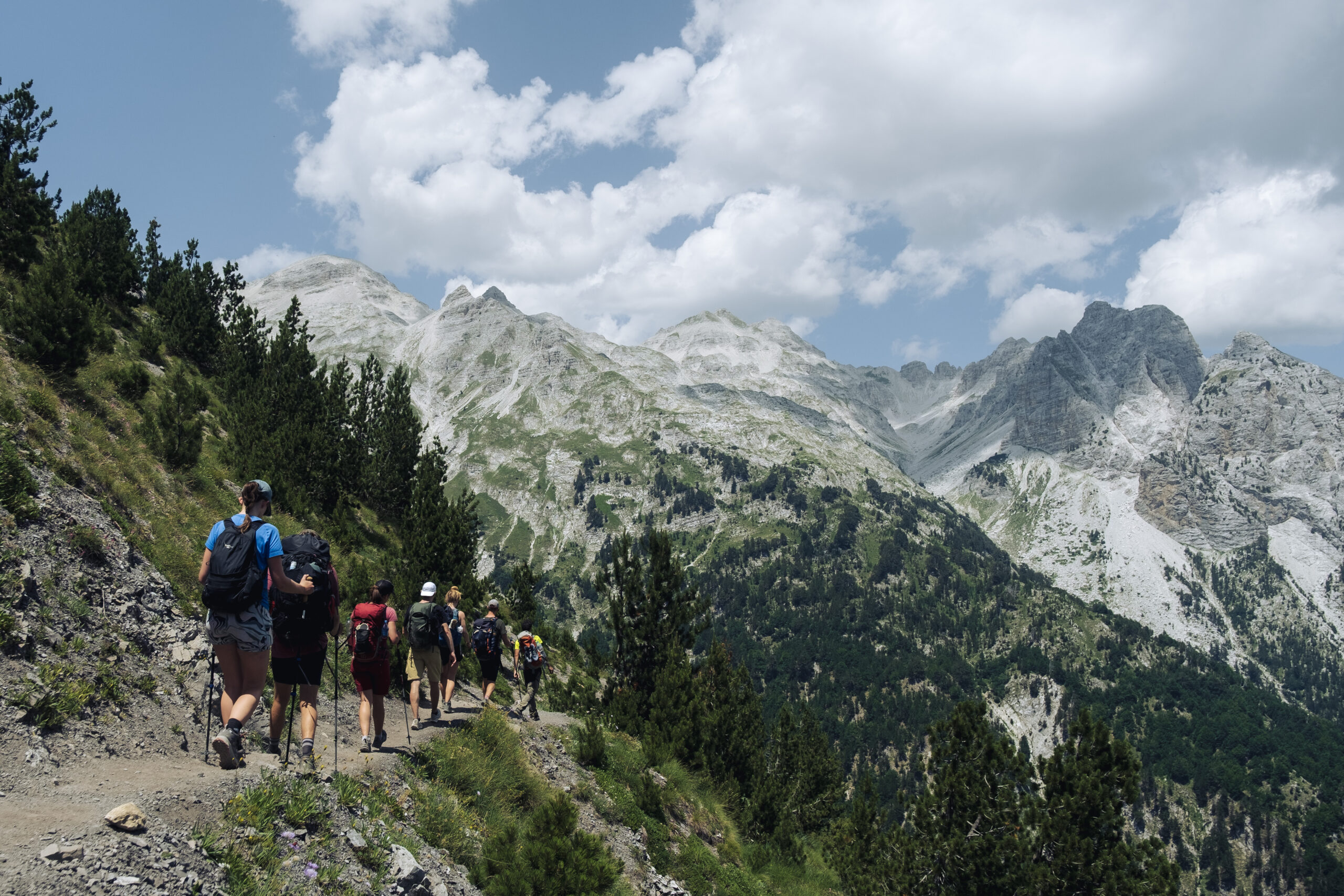
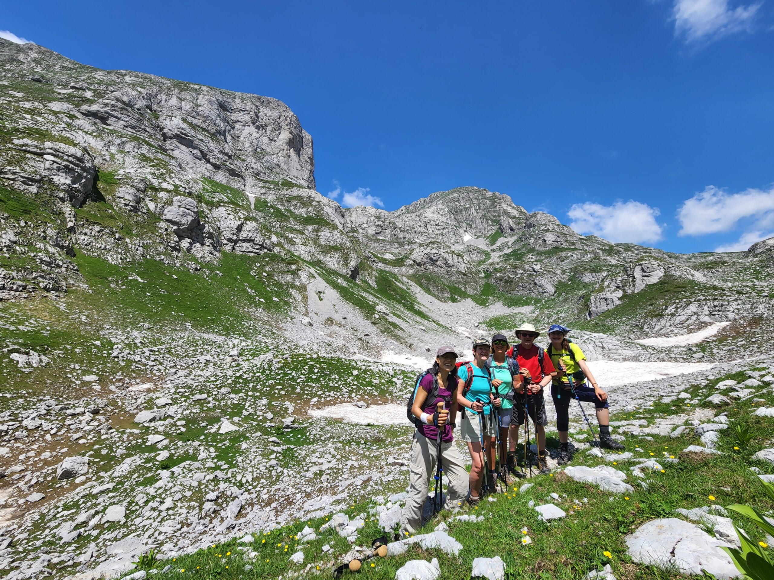
On this hike, you will have a real taste of the Accursed Mountains and the Peaks of the Balkans Trail. It’s a diverse hike bookended with mountain villages and filled with picturesque views. You will walk through meadows, woodland, rocky terrain, and crests and see the most southern glacier in the Northern Hemisphere. This trail has very few tourists, despite its highlights-filled experience.
Cultural Note: Valbona is a Muslim-majority valley with some Catholics who migrated from Theth. There is a legend that the village was founded by an orphan who moved there from Vuthaj/Vusanje, in present-day Montenegro.
Distance: 15.5 km (9.63 mi)
Uphill cumulative: 1215m (3986ft)
Downhill cumulative: 1005m (3300ft)
Minimal elevation: 1215m (3985ft)
Maximal elevation: 2039m (6689ft)
This trail will take you to the Montenegrin border and the country’s highest peak, Kollata e Keqe. For a strong group, the peak can be included in the itinerary. Adding the peak would make this the highest and longest hike of the trip. (to add the peak in the hike, we need advance notice.)
To provide a more enjoyable experience, Balkan Natural Adventure has included this diversion from the classic Peaks of the Balkans trail, since it helps avoid walking on gravelly, dusty tractor roads. From the highest point of the hike, you will see mountain ranges extending to all three countries.
Cultural note: Cerem is a small village, largely abandoned, and at the moment is populated only during the summertime by shepherds. During the winter, the village is empty due to the poor conditions, and the road that connects the village with Valbone is blocked by snow.
Distance: 16.8 km (10.43 mi)
Uphill cumulative: 1100m (3608ft)
Downhill cumulative: 520m (1706ft)
Minimal elevation: 1180m (3871ft)
Maximal elevation: 1920m (6299ft)
After two days of mixed hiking in diverse environments, you will find the track dominated by lush greenery. The entire hike to Doberdol will expose you to the abundant flora of the region that fills the pastures. Villagers on the way will offer their natural products but also other drinks and refreshments. Two makeshift cafes under a canopy of trees give a unique charm to this trail. The scenery will also be filled with sheep, goats, cows, and horses that support the local economy. On this trail, you will pass by some of the oldest woodlands in the world.
Cultural note: Gashi Valley starts in this region. The woodlands have been under UNESCO protection since 2017 as part of the Primeval Beech Forests of the Carpathians. The woodlands are also part of the Ancient Beech Forests of Germany that now stretch over 12 countries.
Distance: 14.7 km (9.13 mi)
Uphill cumulative: 430m (1410ft)
Downhill cumulative: 685m (2247ft)
Minimal elevation: 1509m (4950ft)
Maximal elevation: 2160m (7086ft)
From Doberdol (Albania), you will start a shorter hike to the village of Babino Polje in Montenegro. On the way, you will climb the three border peaks, literarily stepping in three countries within 15 minutes. After this, you will walk along the borderline between Kosovo and Montenegro. You can extend the hike to climb the mountain peak Maja e Qenit, adding about 2 kilometers of walking with stunning views of the Kosovo Mountains. After this, you will end in Babino Polje.
Distance: 17.8 km (11.06 mi)
Uphill cumulative: 922m (3024 ft)
Downhill cumulative: 1323m (4340 ft)
Minimal elevation: 730m (2395 ft)
Maximal elevation: 1740m (5705 ft)
From Vusanje you will begin the hike back to the historic Albanian village of Theth. Historically, the path passes along the craggiest part of the Accursed Mountains, which was once a forbidden zone during the Communist era. The hike will start in direction of Ropojane valley with the rocky gullies on both sides. The valley stretches for about 6.5 km, mainly following the 4WD track until it reaches Ropojane Lake, which rarely fills with water depending on the previous winter’s snowfall. Therefore, we can arrange a car transfer to cover this entire section.
In addition to the dramatic cliffs that form the backdrop for the day’s hike, you will also encounter a historic military bunker and the old border crossing signs as you make your way into Albania. Moreover, as you continue the hike, the trail passes by the scenic Ropojane Lake, which beautifully marks the natural border between Montenegro and Albania. In addition, this spot offers one of the most memorable highlights of the Peaks of the Balkans route. This hike is the rockiest one of the whole trip. It provides numerous mountains, meadows, and valley views. You will end in Theth to close the loop. After a short rest, we will transfer you to your hotel in Shkodra for the night. (Sleepover included)
Searching Availability…


Balkan Natural Aventure is leading tour oprator in the region. We were featured to major newspapers and hold a partner status with travelife certifier.
Destinations
Locations
Balkan Natural Adventure Sh.P.K
Edit Durham, nr 7
30000 Peje, Republic of Kosovo
Balkan Natural Adventure Albania
Rr. Milto Tutulani nr 26/8
1010 Tirana, Albania